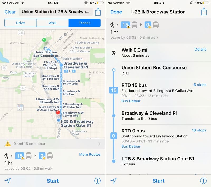
Apple Maps has been updated with comprehensive Transit information for the city of Denver, Colorado, enabling iPhone users in the area to navigate using public transportation, including buses, subways, and commuter rails.
Transit routing was introduced in iOS 9 with support for a limited number of cities, but Apple has since expanded its public transportation coverage for over 20 cities around the world and 30 cities in China.
Apart from Denver, Transit directions are available in Apple Maps for Austin, Sydney, Baltimore, Berlin, Boston, Chicago, London, Los Angeles, Mexico City, Toronto, New York City, Philadelphia, San Francisco, and Washington, DC.
Ahead of the 2016 Summer Olympics, Apple has also added Transit support for cities including Montreal, Portland, Seattle, New South Wales, and Rio de Janeiro.
(Thanks, Ram!)
Discuss this article in our forums
Source: MAC ROUMORS